Bike Washington’s
C&O Canal Bicycling Guide
Mile 10 thru 25
| Trip Planning | Mile-by-Mile | Trip Reports | Info-to-Go |
|
|
Bike Washington’sC&O Canal Bicycling Guide | Mile 10 thru 25 |
|
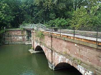
Mile 22.8 - The Seneca Creek Aqueduct
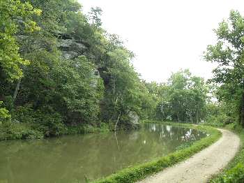
Mile 21 - The cliffs at Blockhouse Point
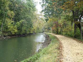
Mile 19 - Early Autumn along the Towpath.
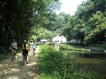
Mile 16.6 - Approaching Swains Lock.
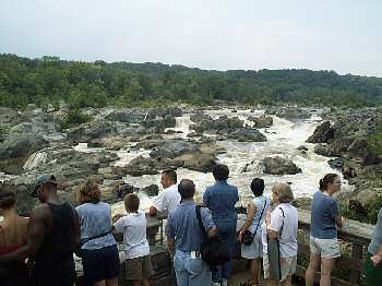
Mile 14 - Enjoying Great Falls
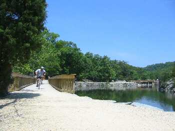
Mile 13.4 - The new bridges at Widewater
The major point of interest in this section is Great Falls, located at mile 14. During nice weather, this area is crawling with folks out to enjoy hiking on the challenging Billy Goat Trail, rock climbing in Mather Gorge, kayaking in the Potomac rapids below Great Falls, or just enjoying a stroll along the towpath. Use caution and be courteous around the pedestrians.
Once you pass Great Falls, the towpath quickly becomes less crowded. Swain's Lock is a nice place to stop for a break. At mile 22.8 are the remains of the Seneca Creek Aqueduct. This three arch aqueduct is the first of eleven such structures along the canal. The western most arch was destroyed by a local thunderstorm flood on Sept 11, 1971.
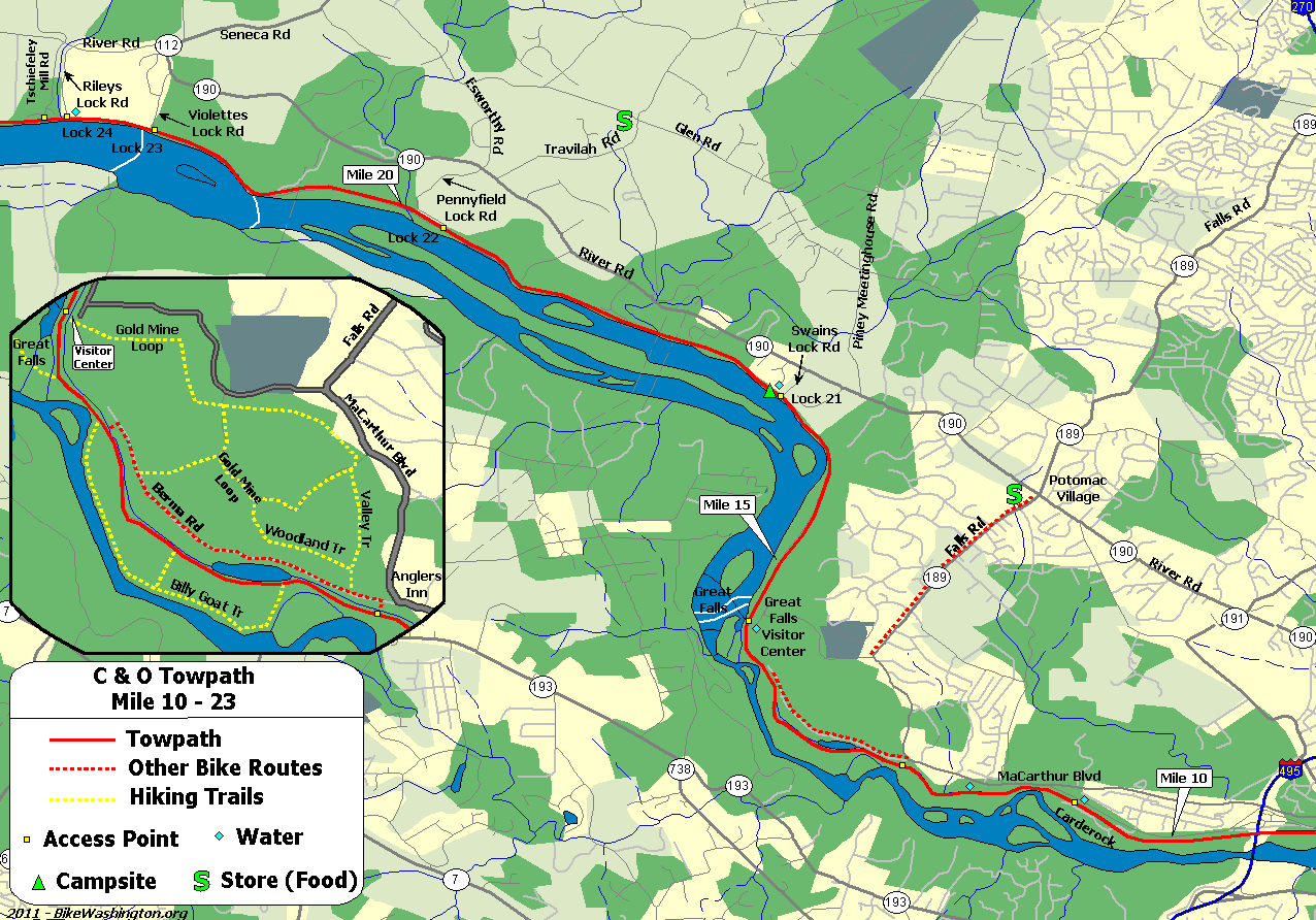
Towpath Map - Mile 10 thru 25
| Mile | Name | Info | |||||
|---|---|---|---|---|---|---|---|
| 10.8 | Carderock Recreational Area (map) | Picnic, rest rooms, water. Very easy access from I-495. | X | X | |||
| 11.5 | Marsden Tract Campground (map) | 301.299.3613: PERMIT REQUIRED - reserved for civic/scout organizations only. $20/night. Call for permit. | X | ||||
| 11.5 | Footbridge | Water on opposite side of canal. Access to MaCarthur, 0.1 mile west of Brickyard Rd. Loading only - No Parking. | X | X | |||
| 12.4 | Old Angler's Inn (map) | Popular free parking area across from Old Angler's Inn on MaCarthur Blvd. VERY Crowded. Access to optional Berma Rd route. | X | ||||
| 13.0 | Bill Goat Hiking Trail A | South Entrance: Excellent 1.7 mile hiking trail along Mather Gorge. Rejoins towpath at Milepost 13.8 Recommended if you have time, but strenuous. No Bikes. | |||||
| 13.8 | Widewater Stop Lock | This structure is used to prevent flood damage downstream. Provides access to Berma Rd, via stairs. | |||||
| 13.8 | Bill Goat Hiking Trail A | North Entrance: Excellent 1.7 mile hiking trail along Mather Gorge. Rejoins towpath at Milepost 12.8 Recommended if you have time, but strenuous. No Bikes. | |||||
| 13.9 | Mary's Wall | 75 foot wall down to river. Provides overlook to Mather Gorge. During big floods, the river rises about 10 feet over the towpath at this point! | |||||
| 14.0 | Great Falls Overlook (map) | Follow footbridges 1/4 miles out to overlook. Sorry NO BIKES allowed. Bike racks available. | |||||
| 14.3 | Great Falls Tavern Visitor Center | 301.767.3714: National Park Visitor Center. Operational Lock #20 located here. Paid parking available. 11710 MacArthur Blvd, Potomac, MD 20854 | X | X | |||
| 14.3 | Great Falls Snack Bar (map) | Hotdogs and burgers. Located in large parking area. | X | ||||
| 16.6 | Swain's Lock #21 | Five Campsites - nearby vehicle access. Newly restored lockhouse is now available for lodging with full amenities. | X | X | X | X | |
| 17.5 | Montgomery County Pumping Station | ||||||
| 19.7 | Pennyfield Lock #22 | Parking Lot - Access to River Road at Esworthy Rd | X | ||||
| 19.7 | Lockhouse 22 | Stay overnight in a real lock house. Rustic, no heat, electricity, or running water. In fact, 3 miles from nearest water source. | X | ||||
| 21.0 | Blockhouse Point cliffs | Towpath extends out into the river while passing some scenic cliffs. | |||||
| 22.1 | Violettes Lock #23 | This lock also marks the end of the watered canal basin. With a few exceptions, the canal basin is mostly abandoned upstream from this location. | X | ||||
| 22.8 | Rileys Lock #24 | Parking and access to River Road. | X | X | |||
| 22.8 | Seneca Creek Aqueduct | The first of eleven aqueducts along the towpath. The north arch was destroyed in 1973 by a thunderstorm flash flood. | |||||
| 26.0 | Horsepen Branch H/B | Hiker/Biker campsite. 1.2 miles from vehicle access at mile 27.2. | X | X |