Bike Washington’s
C&O Canal Bicycling Guide
Mile 25 thru 40
| Trip Planning | Mile-by-Mile | Trip Reports | Info-to-Go |
|
|
Bike Washington’sC&O Canal Bicycling Guide | Mile 25 thru 40 |
|
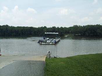
Mile 35.5 - White's Ferry is your crossing to Leesburg, Va
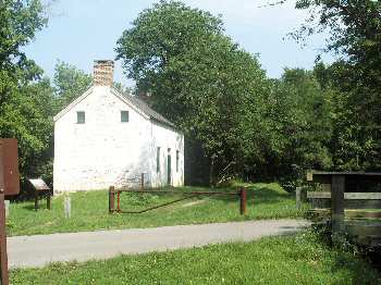
Mile 30.8 - The lockhouse at Edward's Ferry
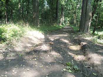
Mile 25 - Mud holes are common in this section
Once you pass the Seneca Creek Aqueduct, the conditions change radically. If you are thinking about biking the entire canal, you may want to try a practice ride in this section to see what it will REALLY be like. First, the canal bed is no longer watered and thus has been completely reclaimed by forest growth. This makes the towpath quite shady, which is great during the summer months, but it does greatly limit the scenery. Also, the wide towpath you had enjoyed eventually changes into a dual track trail. The frequent access points are a thing of the past, so you pass very few folks here. If you find this section boring, then you should rethink trying to do the entire 184 miles.
Expect to see a bunch of wildlife, including towpath favorites such as deer, rabbits, and the occasional fox. The first hiker-biker campsites also begin in this section. Each site contains a water pump and jiffy john. Campsites are chosen on a first-come, first-serve basis.
The major point of interest in this section is Whites Ferry, which had been the only working ferry on the Potomac. It ceased operation in Dec 2020 due to a legal dispute with the landowner on the Virginia side. If service is restored, you can use the ferry to cross over to Leesburg, Va (toll for cars and bikes) where lodging is available. Leesburg is about 4 miles from White's Ferry via Business Route 15. Route 15 is a very busy highway, however there are now paved shoulders along the busiest section.
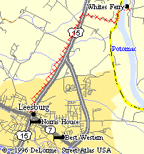
Route between Whites Ferry and Leesburg |
Access Points from River Road:
Access Points from Poolesvile, MD:
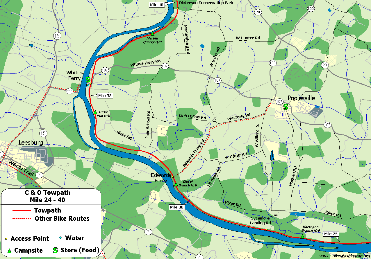
Towpath Map - Mile 25 thru 40
| Mile | Name | Info | |||||
|---|---|---|---|---|---|---|---|
| 26.0 | Horsepen Branch H/B | Hiker/Biker campsite. 1.2 miles from vehicle access at mile 27.2. | X | X | |||
| 27.2 | Mckee-Beshers Wildlife Area | Remote access via Sycamore Landing Rd, 0.75 miles from River Rd. Public hunting area. In July, check out the Sunflower fields during peak bloom. | X | ||||
| 30.5 | Chisel Branch H/B | Hiker/Biker campsite. 0.3 miles from vehicle access at mile 30.8 | X | X | |||
| 30.8 | Edward Ferry Boat Ramp | Access to Poolesville, MD | X | ||||
| 30.9 | Lockhouse 25 (map) | Stay overnight in a real lock house. Rustic, no heat, electricity, or running water. Nearest water is 0.3 miles downriver at campsite. | X | ||||
| 31.9 | Broad Run Trunk Aqueduct | (Ruins) | |||||
| 34.5 | Turtle Run H/B | Hiker/Biker campsite. 1.0 miles from vehicle access at mile 35.5 | X | X | |||
| 35.7 | Whites Ferry (map) | 301-349-5200: NOTE: As of Dec 28, 2020, the Ferry is CLOSED due to a legal dispute. No current access to Leesburg and no estimate if/when it may resume operation. | X | ||||
| 35.7 | White's Ferry Grill | 301.250.3077: Located right off the towpath. The grill management changed in 2019. Currently open 6 days a week - closed Mondays. Check website for latest. | X | ||||
| 38.2 | Marble Quarry H/B | Hiker/Biker Campsite. 1.4 miles from vehicle access at mile 39.6 | X | X | |||
| 39.5 | Dickerson Conservation Park (map) | Access from Martinsburg Rd. | X |