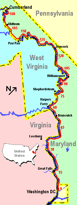
Map of the Towpath
|
The 184.5 mile long
Chesapeake & Ohio Canal
is located along the north bank of the
Potomac River,
starting in Washington, DC and ending in Cumberland, MD.
The canal was built between 1828 and 1850, and it operated sporadically between floods until 1924.
In 1954, US Supreme Court Justice William O. Douglas organized an eight day hike up the canal's
towpath in an effort to save it from being converted to a parkway. His efforts
succeeded, and in 1971 the canal became a National Historic Park.
Today, much of the canal has been drained of water and reclaimed by the forest.
However, the canal's towpath remains a favorite of hikers, joggers, and bicyclists.
Like myself, many local cyclists have considered trying to bike the entire 184
miles between Georgetown and Cumberland, MD. I started biking large sections
of the lower 60 miles with high school buddies back around 1981. (This
was before ATBs so I used my "Sear's Best" Ross 10-speed). Since then,
I've completed five "through trips". Thanks to the new
Great Allegheny Passage Trail,
it is now possible to ride 330 traffic free miles from Washington, DC
all the way to Pittsburgh, PA, as we did in 2007.
You can also read about my earlier trips in 1995,
2003, and 2004.
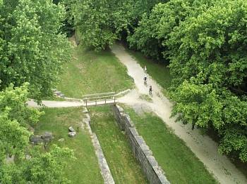
Milepost 73 - The bone dry canal bed across from Shepherstown, WV.
Before you start out on your epic journey, I strongly recommend trying some
shorter trips to prepare yourself. The towpath is not
paved (the surface is typically clay and crushed stone), so it is a bit rough.
Therefore, you will need to build up some calluses on your butt before starting
out (no joke). The first 20 miles is the most heavily used and is a good place
to practice.