Difficulty: V
Bikes:
All
Blue Ridge Challenge
| Miles: 56 Difficulty: V Bikes: All |
Blue Ridge Challenge |
|
|
Related Routes Related Sites |
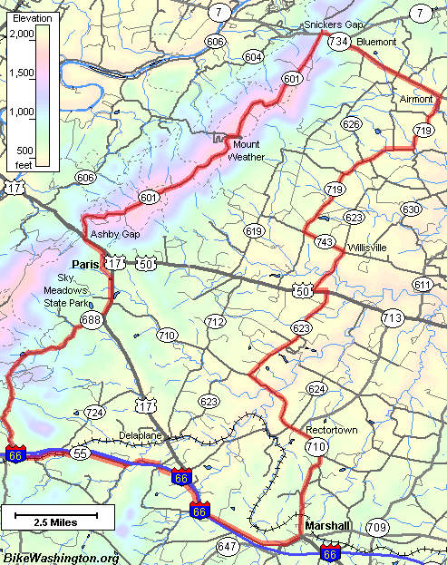
Map of Route |
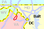
This ride begins in Marshall, VA which is located about 40 miles west of Washington just off I-66. The suggested parking area is at the VDOT parking lot, located about a quarter mile behind the 7-11.
The first 20 miles are actually fairly easy. Between mile 8 and 10 the route passes some really massive estates (you can't even see the homes). You might also note the "quaint" airport off to your left. By the time you reach Airmont, the ridge is looming large on your horizon.
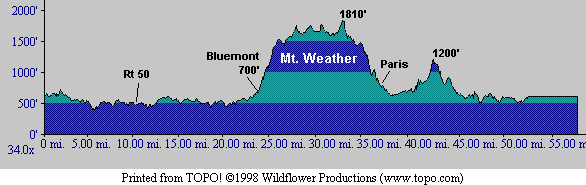
Elevation Cross Section of Route |
|
Print: Cue Sheet
GPS: Download (Help) |
But wait, the fun is not yet over! The second major climb begins around mile 42. This is another steep climb, but no where near as long as the climb out of Bluemont. Once you top this section, there is a nice down hill run to I-66. The final 10 miles is a pretty casual ride along side the interstate.