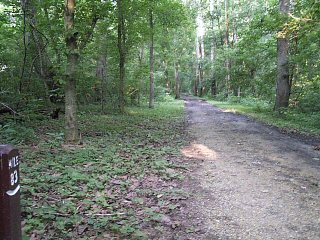
Lonely Towpath at Mile 83. |
I then continued on Dam #4 Road, joining the detour route just south of Downsville. The suggested detour follows narrow, shoulder-less country roads. However, there is practically no traffic along the route, and I always find it to be a very pleasant diversion from the towpath.
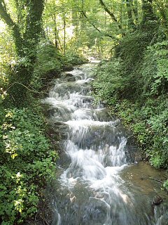
Spontaneous waterfall around mile 80. |
Before I knew it, I was back on the very lonely towpath. Since it was Monday morning, most folks were off to work so the towpath was pretty much left to myself. If you look carefully along the berm side cliffs, you will notice that there are many caves for the next 10 miles or so.
2003 had been a VERY wet year, basically erasing the long drought period of the previous few years. As a result, a number of minor streams along the towpath had turned into really nice waterfalls. I particularly liked the one shown here, somewhere around mile 80.
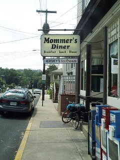
Lunch stop in Brunswick. |
I was all business today, so I pushed on hard to toward Brunswick with a few quick stops along the way. However, I should note that there are a number of really nice diversions along this section, including the Antietam Battlefield and Harpers Ferry National Historic Park (mile 61). Today's lunch stop was Brunswick, MD at mile 55. Mummers Diner was basically the only dining option I could find in town. This family run diner was doing a pretty brisk business this Monday. It took a while before the food arrived, but I was not in a hurry as I was enjoying the air conditioning. Once the food arrived, I ate fast and then grabbed an ice cream cone for the road.
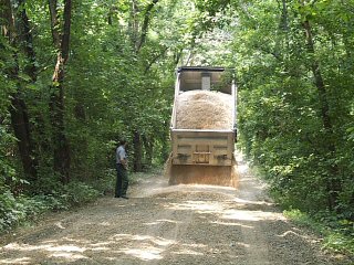
Towpath repairs at mile 54. |
The section of towpath in Brunswick is one of the few locations open to motor vehicle traffic, since it provides the only access to Brunswick Family Campground. As a result, the towpath is generally in terrible condition for the next mile down river of Brunswick. However, on this day a major resurfacing project was underway. I stopped for a few minutes to chat with the ranger and watch the equipment at work.
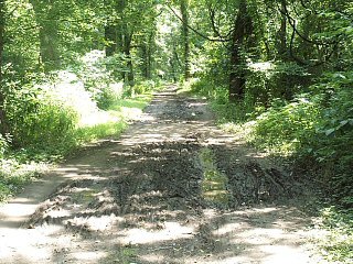
A medium sized mud-hole. |
I continued on to Point-of-Rocks, MD (mile 48), where I made a quick drink stop. Traditionally, the towpath is pretty muddy the next few miles down river from Point-of-Rocks. However, it was not really too bad on this trip. It was usually easily to navigate around the few mud-holes in this section.
At mile 42, I crossed the beautiful Monocacy Aqueduct. The LONG awaited renovation project was finally underway. I stopped on the far side, where a diver was doing underwater repair work on one of the piers. I spent a few minutes chatting with the support crew. Once completed, they will finally be able to remove the ugly steel exo-skeleton framework which has been holding the aqueduct together for the past 30 years.
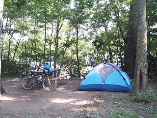
Third Campsite at Horsepen Branch. |
Down river from the Aqueduct, conditions really became ugly. The next 15 miles were in absolutely terrible condition (worst I have ever seen). The mud-holes were so large, it was impossible to go around many. I found that with my bike being somewhat top heavy, my wheels would try to slip out from under me when I tried to drive around the edge of the holes. So I resigned to drive straight through most of the holes. A few month later, this entire 15-mile section was closed after Hurricane Isabel. However, I think it was really closed due to the mud-holes. I hear, one year later, that the repair work along this section used coarse grade gravel to fill the holes, which is not much of an improvement.
My plan for the evening was to make one last food and drink stop at the Whites Ferry Store and then establish camp at one of the primitive hiker/biker campsites just down river. Unfortunately, the store was then closed on Monday and Tuesdays (they can't find enough staff). So I continued on down river without my last supply stop. I passed up the first two campsites and finally stopped for the evening at the very secluded Horsepen Branch site at mile 26.