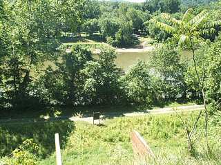
Looking down on the Towpath from the Western Maryland Rail Trail. |
As expected, the towpath was a bit of a muddy mess in spots. However, it was still quite passable. After only seven miles, I was able to hop over to the new extension of the Western Maryland Rail Trail. This paved trail runs 20 miles parallel to the towpath on the berm side of the canal ditch. The trail also offers some nice views of the river and towpath.
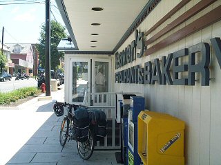
Lunch at Weaver's. |
Around 11:30 am or so, I entered Hancock, MD. When you first enter town, you might notice the C&O Bike Shop. This great shop, which opened just a few years ago, is basically the only real bicycle shop on the entire trail. After a quick chat with the owner, it was time to head over to Weaver's Restaurant for lunch. Weavers is basically a landmark on the canal, and still very popular with the locals. The place was pretty full, but I had the lunch counter to myself.
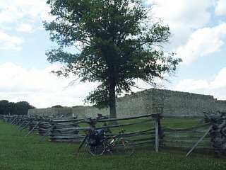
Fort Frederick. |
After a heavy lunch, I eased out of town continuing on the Western Maryland Rail Trail. About a mile prior to the trail end, I hopped back over to the towpath. (If you ride all the way to the end of the rail trail, you will need to ride along Rt 56 for about a mile to rejoin to the towpath at Fort Frederick). The towpath was almost completely dry by this point.
After passing Big Pool, I stopped for a drink and few pictures at Fort Frederick (Mile 112). This impressive stone fort was built during the French and Indian Wars (1750's or so). The afternoon was becoming pretty hot by now, so after finishing my drink I headed by to the relative coolness of the shaded towpath.
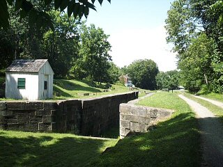
Four Locks. |
A couple miles down the towpath, I passed by four back-to-back locks located at mile 109. They call this area Four Locks (pretty clever!). This is one of the few places where the canal takes an over-land shortcut to avoid following a long river bend. (another case is the Paw-Paw Tunnel). The four locks are kept in very good condition, and hence make a nice photo op.
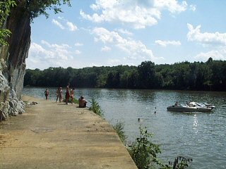
Upstream from Dam Number 5. |
Just below Four Locks is a large slack-water area on the Potomac River, created by Dam #5. Today, this reservoir is a favorite recreation spot for the locals. Back in the day, the canal briefly entered the river at this point to navigate around the large cliff, shown to the right. The towpath now makes a nice diving platform.
My final stop for the day was the town of Williamsport, MD (mile 100). At this point, I left the towpath for a 3 mile ride inland to my second night stop at Jellystone Campgrounds.
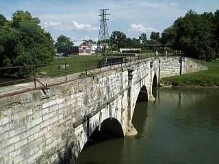
Conococheague Aqueduct at Williamsport. |
The campground, located south of Williamsport on Rt 63, was very nice. As you might have guessed, it is mainly geared toward RVs and families, but they do have some tent campsites and cabins. After setting up camp, I took a dip in the pool, hit the showers, and then cooked dinner. I then enjoyed the campground's other nice features, including ice cream stand and outdoor movie screen (which unfortunately was showing "The Goonies" that evening).