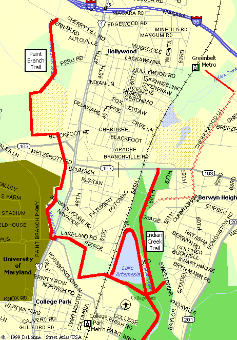
Map of Trails |
After passing College Park Airport, you will approach Lake Artemesia. At this point you will find that trail goes off in three different directions. The first time I rode this section (during the Washington to Baltimore ride), I admit having a bit of trouble finding the correct route. Basically, if you want to head over the the University, take the path to the left. If you are heading to Greenbelt, cross over the "hump" on the right, and then make a left to continue on the path along the creek.
One nice feature of this trail network is that it provides easy access to the Greenbelt Metro Station. This station is located right next to the US Government's Agriculture Research Center, which is a long time favorite riding area for local cyclists. This station also provides a good "jumping off" point for rides to Baltimore and Annapolis.
Connecting Rides:
- 38 Miles - Greenbelt to Bay
- 47 Miles - Washington to Baltimore
To reach Greenbelt Metro:
- At Lake Artemesia, cross the hump bridge and then follow the Indian Creek Trail.
- Make a Right at the first road crossing, Berwyn Rd.
- At the next Left, turn onto Ruatan St.
- Go about two blocks and make a left onto 60th Ave.
- Cross Greenbelt Rd at light. Becomes Cherrywood Ln (which has some nice bike lanes)
- Cherrywood Ln will take you right to the metro station. It will also take you over I-95 to the Ag Center and Greenbelt proper.
| Overview Page >>> |